Map Design
Discover Clermont
Visitors Bureau
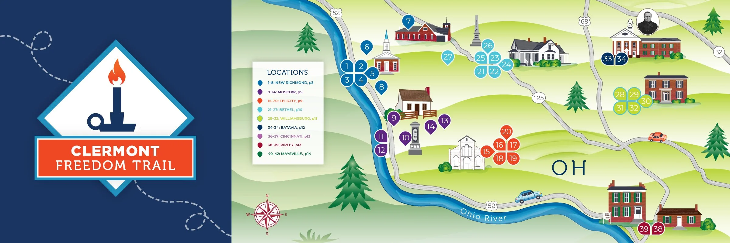
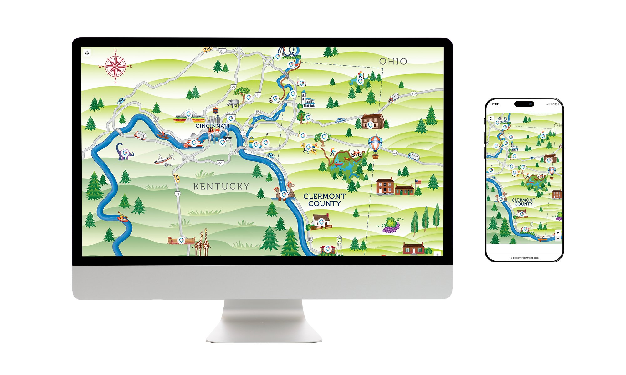
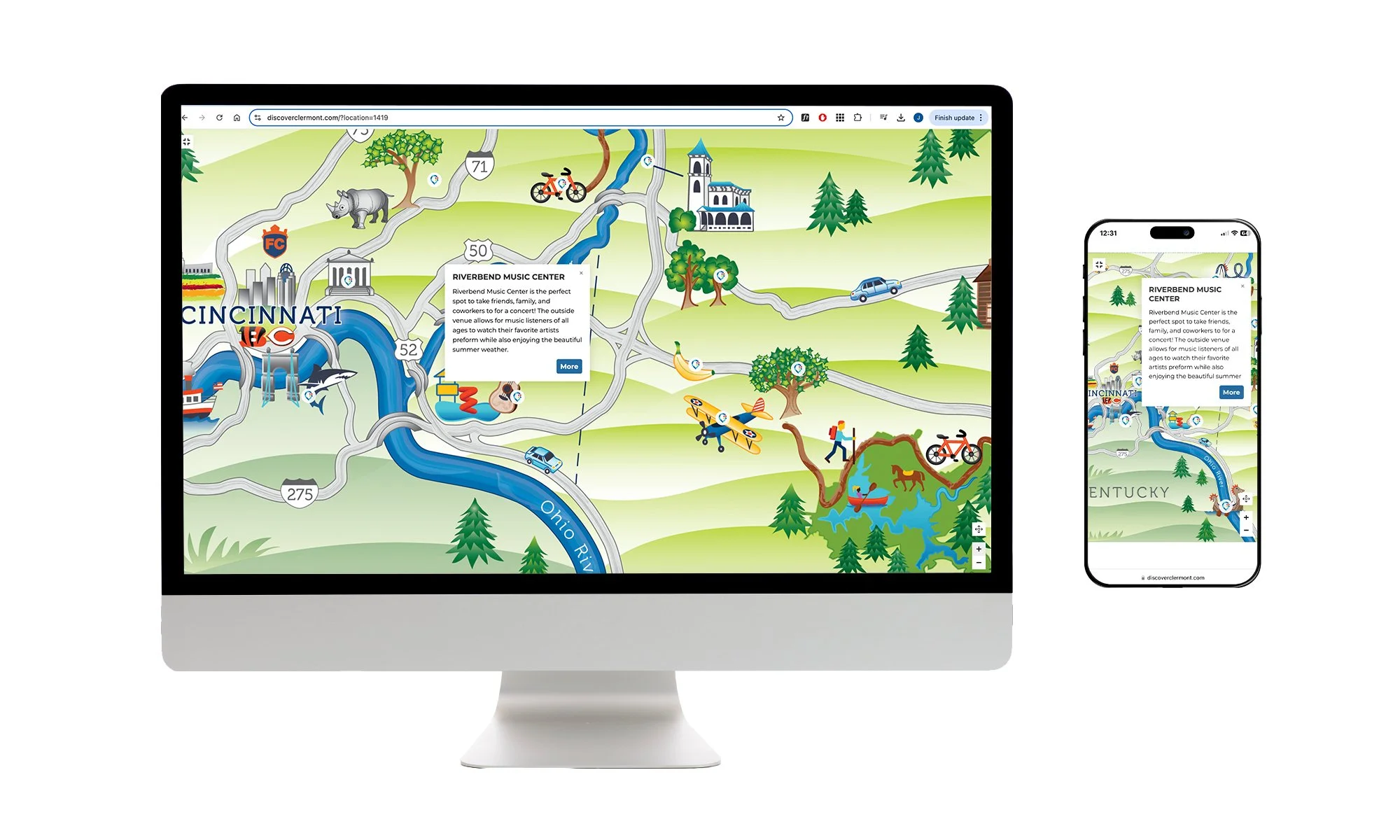
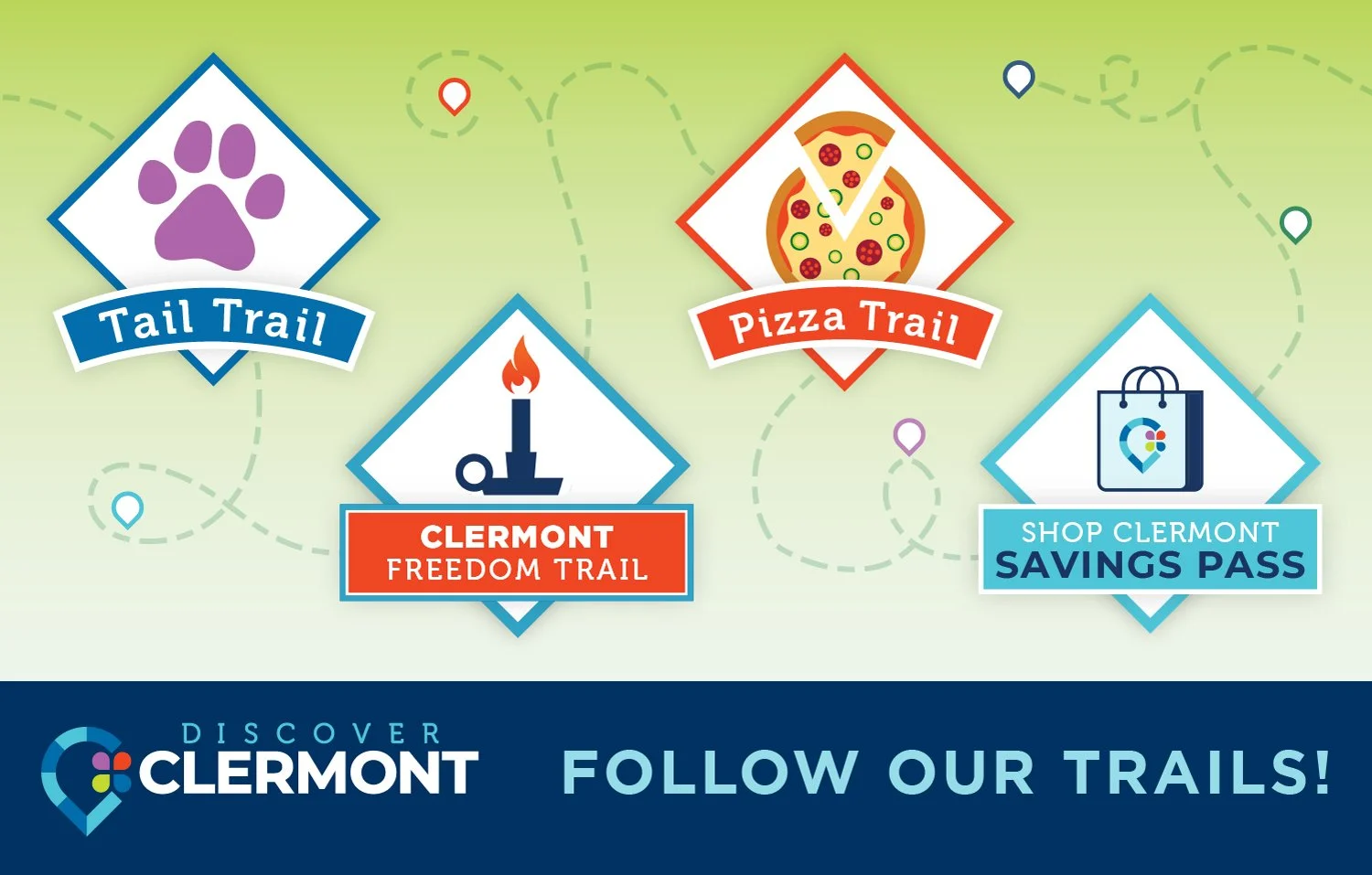
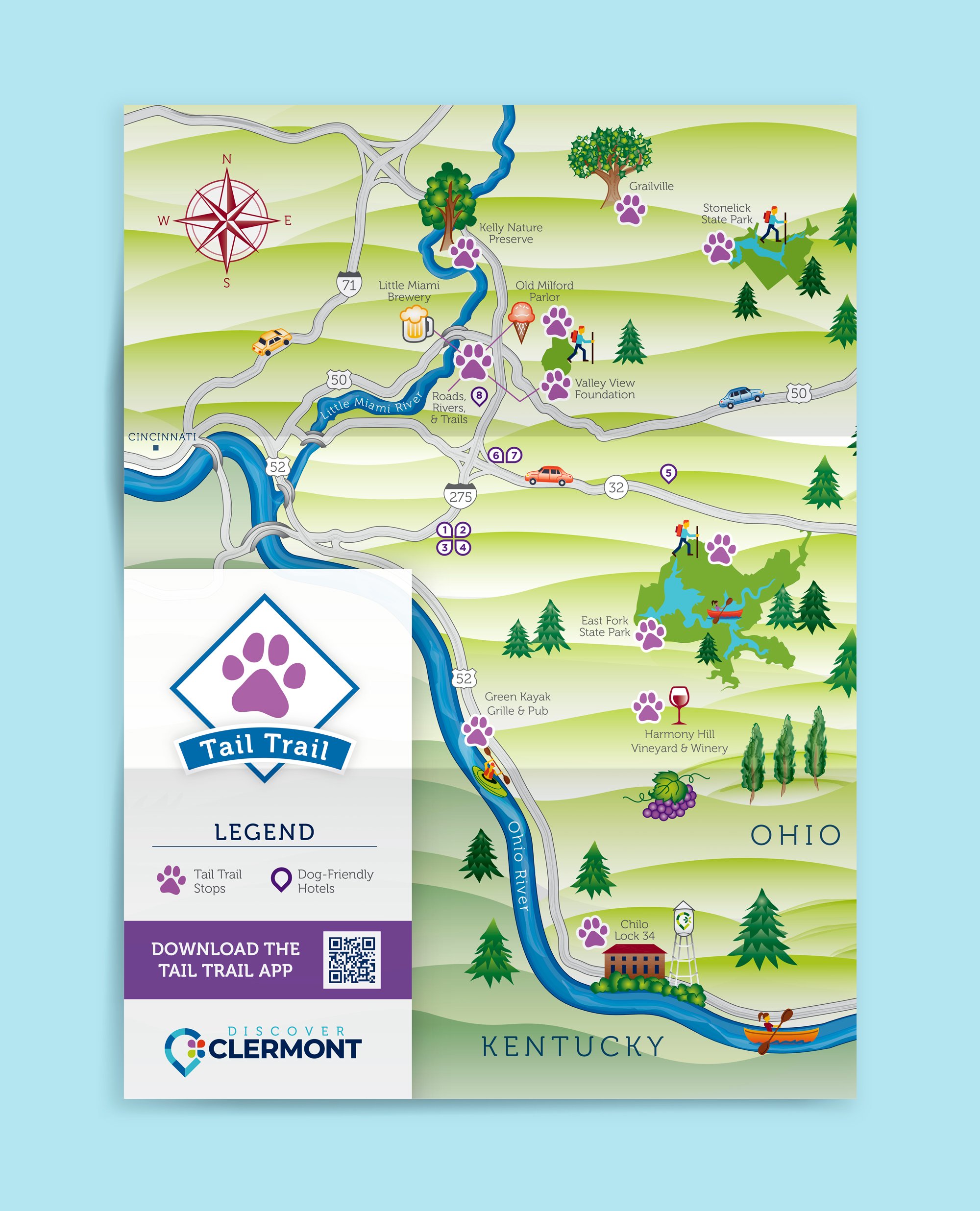
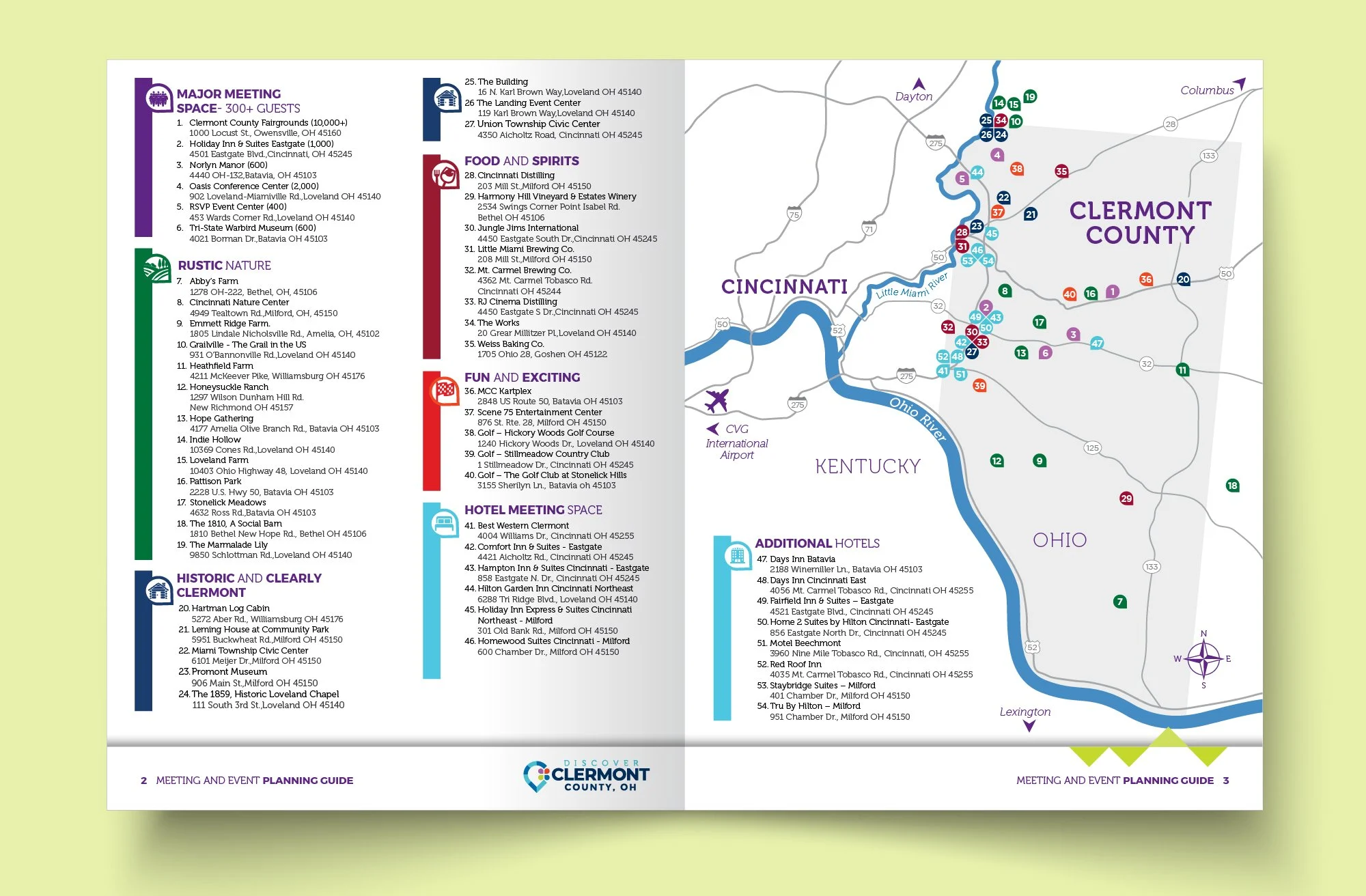
Clermont County, OH has lots to offer tourists and residents alike. Working with the Visitors Bureau, I design maps to showcase local attractions and activities. I’ve illustrated a lively map of the region, and update it regularly to highlight a variety of themes: historical tours such as the Underground Railroad and President Grant, or local gems like pizza places and dog-friendly spots. Check out an interactive visitor map on their website. I also designed a visual system for map logos, so each trail has its own identity within a consistent brand. (fun fact: Clermont is an old French word meaning “clear hills.”)